Finding self-afforested areas by means of remote sensing and GIS technologies
Published: 2021-06-03
On behalf of the Ministry of Environment, the URIFFM researchers have done a number of studies on the methodology of estimating self-afforested areas by means of remote sensing and thus, they developed an algorithm for their mensuration.
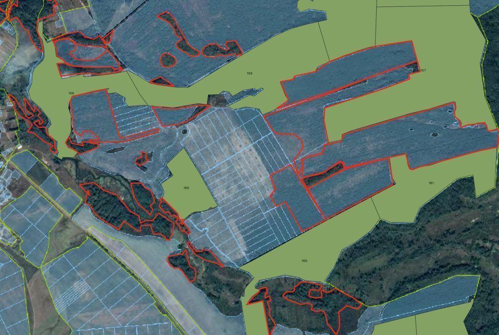
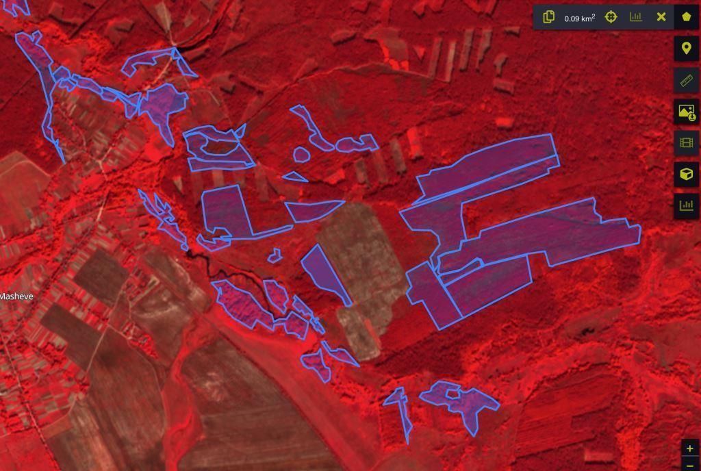
The studies involved three stages. As a result of the first stage, the satellite images of the self-afforested areas in Cherkasy and Khmelnytsk Regions were verified and decoded. The researchers estimated those areas and designed a vector map for them.
In the second stage the URIFFM researchers performed training for the staff in SE ‘Forest Innovation and Analytical Centre’ and developed the guidelines.
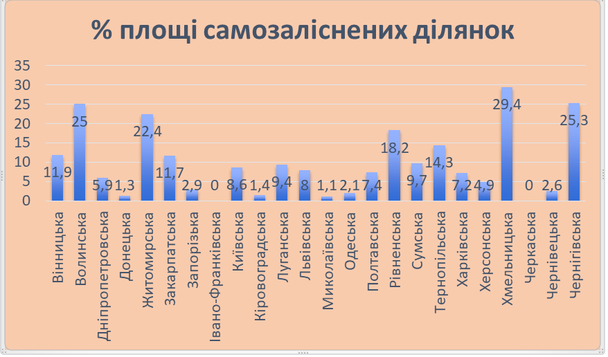
Self-afforested areas in Ukraine by Regions, %
The third stage of the studies involved the mensuration and description of the self-afforested areas in former Semenivka District in Chernigiv Region. The scientists found that self-afforested and non-accounted forest areas make 9.1% of all the district’s forests.
The URIFFM researchers have developed an algorithm to carry out a mensuration and description of self-afforested areas by means of the remote sensing data and GIS technologies. When carrying out a mensuration and description of the self-afforested areas on the country’s scale, this algorithm can be used along with the Ukraine’s Forests geoportal which will allow unifying and synchronizing the data.
Ph.D. Oleksandr Borysenko
Head of the Laboratory of Advanced Information Technologies, URIFFM